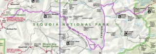
The High Sierra Trail (HST) is a hiking trail in Sequoia National Park, California. The trail crosses the Sierra Nevada from west to east.
From the plateau of the Giant Forest at Crescent Meadow (elevation 6,700 ft) the trail travels high on the northern wall of the canyon of the Middle Fork of the Kaweah River to Bearpaw Meadow. This first 11.4 miles of the trail is a popular though strenuous two-day round trip hike. The Bearpaw Meadow High Sierra Camp (a simple tent hotel) located here dates back to 1934. Leaving the meadow, the trail climbs through the Hamilton Lakes Basin to Kaweah Gap which, at 10,700 feet, is one of the lowest passes over the Great Western Divide within the park. From this pass, the route descends into Big Arroyo and then climbs to the Chagoopa Plateau, only to drop again to 6,700 feet in the Kern River Canyon. After following along the Kern River, it turns east and climbs parallel to Wallace Creek to the junction with the John Muir Trail and Pacific Crest Trail 48.9 miles from Crescent Meadow. This is the end of the High Sierra Trail. Hikers may continue on the John Muir Trail 12.6 miles to the summit of Mount Whitney. The Mount Whitney Trail branches to the east from the John Muir Trail 2.4 miles south of Mount Whitney’s summit, and descends to Whitney Portal located at the end of the road from Lone Pine, California. From Crescent Meadow to Whitney Portal, the trail is 72.2 miles long and often takes 6 days or more for the average hiker to complete. The fastest claimed time to traverse is 15 hours 46 minutes, by Leor Pantilat. Work began on the High Sierra Trail in 1928, and it was the first Sierra trail built solely for recreational use.

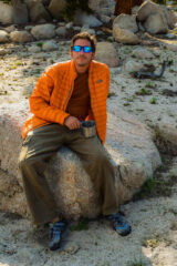
We have spent total of 6 days backpacking the High Sierra Trail finishing up at the summit of Mount Whitney. Prior to that we have added another 4 day backpacking trip in the area – exploring Cottonwood Lakes, Mount Langley and summiting Mount Whitney once more.
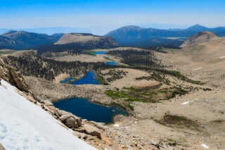
Cottonwood Lakes Trail is located near Lone Pine, which was the start of our journey. Starting at Horseshoe Meadow we arrived at the lakes around noon on the first day and spent the rest of the day exploring the area.
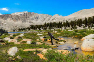
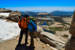
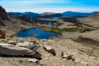
We ended up spending one night there before summiting Mount Langley the next day and moving forward to Mosquito Lake. Mount Langley is one of the easiest of California’s fourteeners to climb. From scenic Cottonwood Lakes, the trail climbs through New Army Pass. From there hikers travel cross-country to Old Army Pass, where they may pick up the recently constructed Class 1 Mount Langley Trail, which follows a series of large rock cairns for the two mile push to the summit. New Army Pass is 7 miles from the trailhead at Horseshoe Meadow and is an easier but longer approach to Langley than Old Army Pass via Cottonwood Lakes Trail. Due to the elevation, both passes are covered with snow most of the year. New Army Pass sits on a south-facing slope and it tends to clear of snow somewhat earlier in the season. Old Army Pass is only clear of snow for less than two months per year, from mid-August to early October. During the winter months, even the paved road to Horseshoe Meadow is closed, making the summit significantly harder to reach.
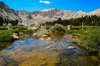
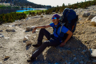
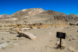
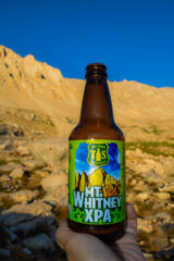
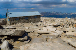
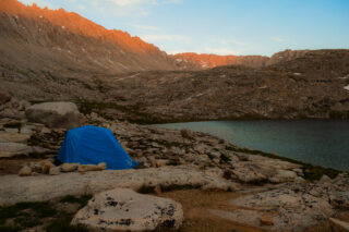
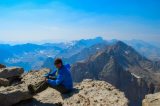
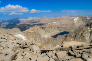
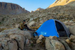
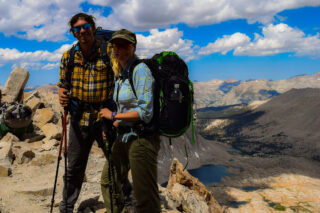
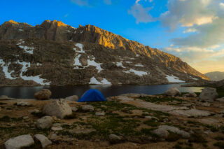
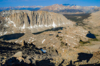
After Mosquito Lake, we spent Day 3 hiking towards Crabtree Meadow and Guitar Lake where we spent the night before summiting Mount Whitney for the first time. Camping at the Guitar Lake is one of my favorite times. For some reason that place just makes everything so peaceful. Mount Whitney towering above our tent, we stayed up to watch stars and planning our next day. Starting our summit bid around 5am in the dark and making our way up in the steep switchbacks. 3.1 miles from Guitar Lake we finally reached the junction for the summit. We took a moment to soak in the spectacular views of the lakes below us and the mountain range in the distance. Dropping our bags we made our way to the summit just with small day pack. From this point, we only had 2.4 miles to go to the summit of Mt. Whitney, the climax of our entire trip. We headed north on the rocky, exposed route that traverses the western slope. The true summit can be difficult to spot until you are closer, but you can look for the Mt. Whitney Hut that was built over 100 years ago perched atop of one of the flat peaks. Up on Mount Whitney Summit, at elevation of 14,505 feet, we ate celebratory pasta lunch and drank Mt. Whitney IPA.

The descent down to Whitney Portal is my least favorite part of Mount Whitney summit and we were both very glad that we didn’t have to take it up to the summit. It is almost 10 miles downhill loosing all the elevation we gained in the past few days. Once at the Portal, burgers and fries from local restaurant is a must!


Our 2nd big Sierra trip was High Sierra Trail, that we backpacked over 6 days, starting at Sequoia National Park and finishing once again, at the summit of Mount Whitney and Whitney Portal.
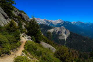
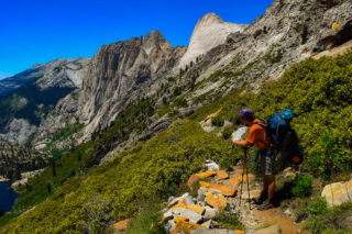
The opening segment of the High Sierra Trail is perhaps one of the most beautiful footpaths in the western half of Sequoia. Beginning at Crescent Meadow, following the paved path until the High Sierra Trail branches away on the right to travel through a dense forest of white firs sheltering a dense understory of ferns.
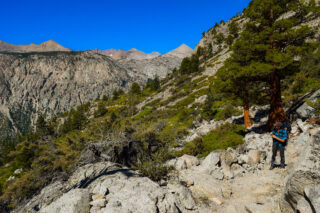
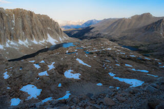
After cresting the rim of the Giant Forest Plateau, the trail climbs gradually, sometimes undulating along the north rim of Middle Fork Kaweah River Canyon. As it does so, it winds in and out of various named creeks, including Panther, Mehrten, and Buck, as well as unnamed tributaries. As we progressed west to north, we sampled an ever-changing mixture of montane environments that transition according to slope aspect.
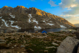
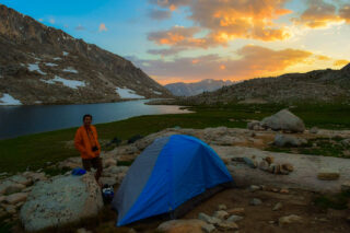
Views across the canyon toward the high peaks of the Great Western Divide and Paradise Ridge hold attention throughout. Although you can camp at Mehrten Creek and Buck Creek, your best bet for your first night is Bearpaw Meadow. Aside from being a gorgeous location, Bearpaw has a large collection of camping options, including the historic High Sierra Camp. Open from mid-June to mid-September, the camp features 6 tent cabins, bedding, showers, and home-cooked meals.


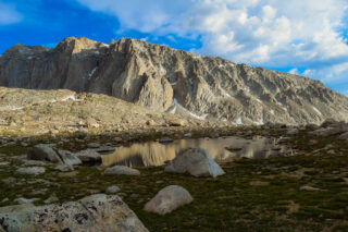
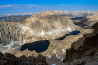
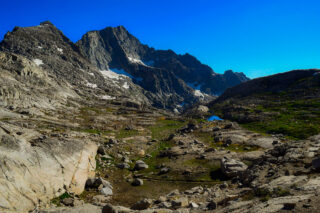
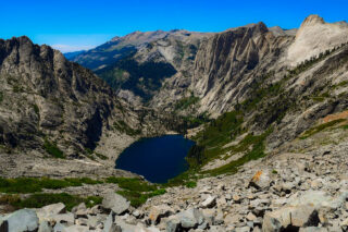
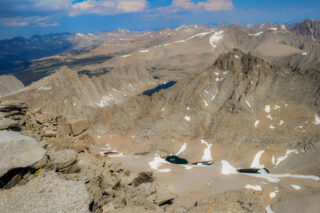
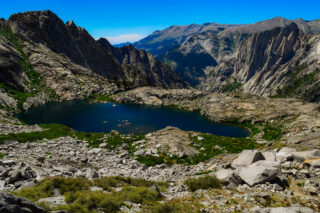
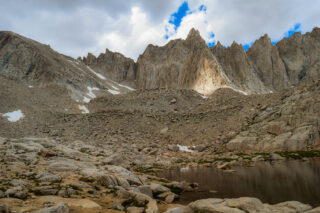
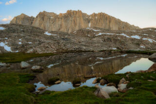
Beyond Bearpaw Meadow you begin the steady climb toward Kaweah Gap. floods. Continuing past Lone Pine Creek, the High Sierra Trail climbs obliquely along the northern wall of Hamilton Creek’s dramatic canyon. High above to the left, you will see a towering granite formation known variously as Valhalla (the officially recognized name) or Angels Wings. After crossing Hamilton Creek just above a waterfall, you will continue beyond marshy, lower Hamilton Lake before reaching the larger lake set within a stunning glacial basin. Pinnacles and minarets, all a testament to the power of glacial scouring, stand thousands of feet above the sparkling lake.
From Hamilton Lake, the route continues east toward Kaweah Gap by way of the northern wall of Hamilton Lake’s basin. After switchbacking nearly 1,000’ vertical feet, the High Sierra Trail passes through a gouged-out semi-tunnel created to avoid the damaging effects of avalanches.
Beyond Precipice Lake, the High Sierra Trail next takes you through the alpine wonderland of Kaweah Gap. As far as passes go, Kaweah Gap is relatively lower in elevation (10,709’) compared to nearby Black Rock Pass and Elizabeth Pass. Beyond the Gap, the High Sierra Trail switchbacks down the rocky backside of the Great Western Divide as it enters into the vast Kern River watershed.
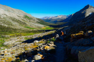
As the High Sierra Trail sidles up to Big Arroyo, you begin a long, gradual descent along the center of a beautiful U-shaped valley that provides excellent examples of glacial erosion.
Soon enough, the High Sierra Trail passes just north of Moraine Lake.
After crossing Funston Creek, the High Sierra Trail commences a long descent from the Chagoopa Plateau into the depths of Kern Canyon. The trail takes a long, arching switchback through recovering forest into open pine forest as you lose elevation. Soon we came upon the Kern Hot Springs, which will bring a glorious measure of relief to your aches and pains. Kern Hot Springs lies upstream from the junction with the southbound Kern River Trail. The hot springs emanate from several openings on a grassy slope just above the river, and a concrete basin about the size of a bathtub catches the hot water. Enjoy the blissful soak to your heart’s content, but be sure to wash off any bug repellant, sunscreen, and as much of your own filth so that you do not ruin the experience for others.
Beyond the springs, we progressed up-canyon crossing a number of named and unnamed creeks. The beauty of the canyon compensates the long approach to your next camping area with a handful of waterfalls and soaring granitic walls rising high up toward subalpine terrain. The next established camping area arrives at Junction Meadow, so-called because the High Sierra Trail meets the Colby Pass Trail near where the Kern-Kaweah River feeds into the Kern River. Several good camping areas surround a bear locker. Since the next segment of the High Sierra Trail commences a steep climb through Wallace Creek’s canyon before reaching the high steppes west of the Sierra Crest, this is a good option for calling it a day.
Making our way up Mt. Whitney’s steep western slope, soon reaching the junction with the combined John Muir Trail/Pacific Crest Trail. From here, you head south as you merge into the considerable traffic of combined JMT and PCT through-hikers. Do not expect a lot of solitude from this point on as you approach the apex of the Sierra Nevada Mountain range.
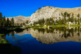
From Crabtree, you will approach the treeline again and return to the familiar, soaring alpine habitats characterized by trickling creeks, wildflowers and meadows.
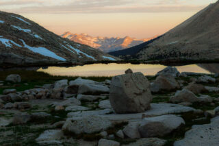
Soon arriving at Guitar lakes once again, which temporarily hosts the cumulative traffic of the JMT, PCT, and High Sierra Trail as they approach either the ends or the apex of their journey. Again, I have to give Guitar Lake credit for its stunning sunsets and beautifully blue waters.
However you wish to enjoy your time on the summit, bear in mind that you still have a very long way to go on the day. Not only will you need to backtrack to the John Muir Trail junction, you will need to make the brief climb up and over Trail Crest (itself 13,400’) before dropping down the fabled 97 Switchbacks to Trail Camp. You will want to make your return journey before the afternoon’s heat gives birth to convective currents that spawn the Sierra’s legendary afternoon thunderstorms.
Each time when we were at the summit of Mount Whitney, we witnessed clouds and storm coming our way even before 11am. Always plan on leaving the summit by noon in order to get to cover before the storms pick up in earnest, usually around 3 or 4 in the afternoon.

Permit
Normally, if you wish to hike Mt Whitney on only 1 or 2 days you can get a permit through a lottery that opens on February 1st. If you have 6 days to enjoy the nature then I suggest the following route that we did, which only requires a wilderness permit to be picked before the trip at the visitor center in Lone Pine.