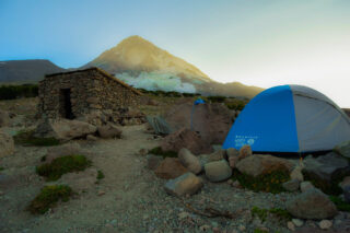
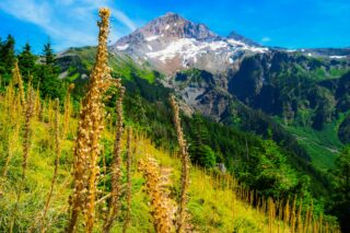
Timberline Trail is a hiking trail around Mount Hood in Oregon. It is mostly in wilderness but also goes near Timberline Lodge, Cloud Cap Inn (the oldest building on Mount Hood), and Mount Hood Meadows ski area.
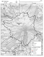
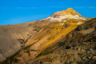
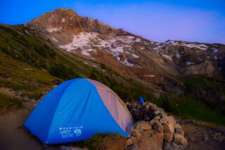
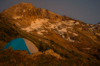
The hike is typically completed in three to five days, but some ambitious hikers complete it in one or two days. The trail, Forest Service trail #600, shares eleven miles (18 km) with the Pacific Crest Trail and alternates above and below the timberline. The trail is rerouted periodically due to washouts and to avoid sensitive high altitude and alpine meadows. It has a handful of informal campsites for backpackers, although camping is permitted anywhere outside the meadows and at least 200 feet (61 m) from water bodies. There are several hazardous river and stream crossings, especially on the west side of the mountain and at the landslide-prone Eliot Branch near Cloud Cap which closed the trail there in 2007. The trail has several significant vertical ascents and descents totaling 9,000 feet (2,700 m), mostly at canyon crossings.
The trail is most easily accessible from the Timberline Lodge, which has Forest Service permitted parking (which you can purchase at Timberline Lodge) for backpackers, and through numerous connecting trails. There are multiple popular trail variations one can add as well, including Ramona Falls and Paradise Loop Trail.
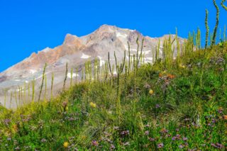

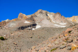

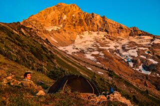
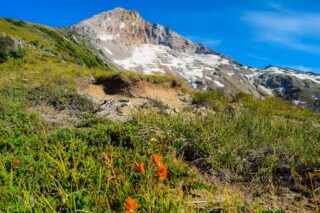
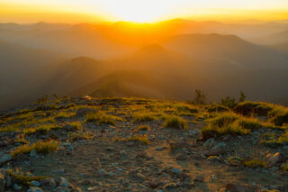
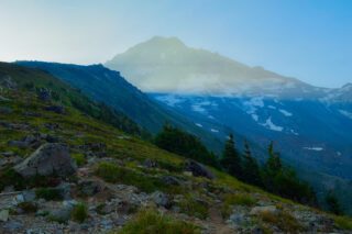
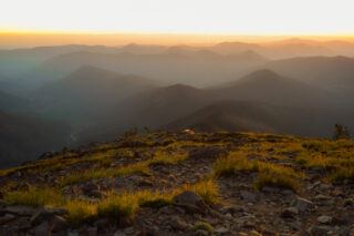
Beautiful old forests, sprawling meadows full of wildflowers, some rocky/sandy/exposed sections. This hike really has it all and shows you how diverse the area around Mount Hood is. And the best part? Constant, ever-changing views of the mountain throughout the hike. The Timberline Trail also overlaps with PCT for about 10 miles, so you usually get to meet some current thru-hikers depending on the season. Most people hike the Timberline Trail in July or August. You can generally expect hotter, drier weather in this region in August and September than you can in July. Streams will also be lower in late summer as snowmelt dies off, and this is usually accompanied by a drop in the local mosquito population. There is no special permitting to hike the Timberline Trail. You’ll just fill out a self-issued permit at the beginning of your hike.


Due to a severe storm in 2020, part of the Timberline Trail have been rerouted due to trail damage between the Muddy Fork and Yocum Ridge Trail on the west side of the mountain. The section of Mt Hoods Timberline Trail that rises from the Muddy Fork crossing and wraps around the lower section of Yocum Ridge on the way to Ramona Falls went through large, shaded old-growth forest, a section of the trail gently hugging the contours of the slope with little steepness despite some wavering in elevation. The work to clear this is going to be incredibly technical, dangerous, and take a long time. For all of 2021 backpackers, and likely far beyond, hikers, backpackers, and runners would do well to avoid the nearly 2 miles of complete devastation. There are easy detour options on trails that remove the danger to hikers and the search and rescue crews that would be rescuing them in the event of an easily avoidable accident. To avoid the destroyed section of the Timberline Trail from the Top Spur Trail-PCT-Timberline Junction on the west side of Bald Mountain, follow the PCT south, rejoining the Timberline Trail close to the Sandy River crossing. Alternatively, the Ramona Falls trail can be followed which runs along the lovely creek coming down from the falls. The detour with the PCT actually reduces the mileage of the loop around Mt. Hood by about a mile and a half.
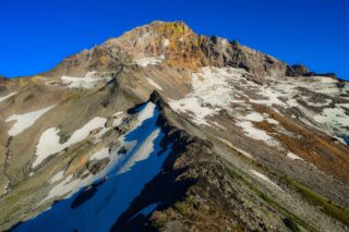
Hiking the Timberline Trail requires multiple river crossings (most unmaintained and without permanent infrastructure), and dips in and out of glacial drainages amounting to 10,875 ft of elevation gain for the trail. The total mileage of the loop changes depending on the start/end point. There are several side hikes that we opted to add as well which moved our total mileage to 66 miles in 4 days.

- Campfires are prohibited within 500 ft / 150 m of Ramona Falls and McNeil Point, within the tree-covered island in Elk Cove and Elk Meadows, and in Paradise Park.
- Camping is prohibited in all meadows, within the tree-covered islands of Elk Cove and Elk Meadows, and within 500 ft / 150 m of Ramona Falls.
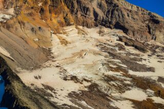
- Historically, the Newton, Eliot, Coe, Muddy Fork, Sandy, and White Rivers are the most challenging fords but they are usually no more than knee-deep.
- Permits are free and available at trailheads (or shortly down the trail from the trailheads).
- Water found along the Timberline Trail should be treated before consumption.
- Cloud Cap Trailhead, Top Spur Trailhead, and Ramona Falls Trailhead require a day-use fee of $5 per day between May 15 and October 15 (for parked cars). You can purchase day passes for $5 each or an Annual Northwest Forest Pass for $30. The America the Beautiful Pass ($80) also covers these trailheads.
- There was a large washout at the crossing of Eliot Branch in 2016 – this has been rerouted to cross downstream of where the trail previously crossed Eliot Branch. There is no bridge across the Eliot Branch where the Timberline Trail crosses. This reroute requires no additional navigation and you need simply to follow the trail as you would normally.