The decision to climb Volcan Concepcion formed in my head long time before I actually made it to Nicaragua. We opted for a Planeterra 2 night stay with local families while on the island and a couple of friends decided to join me on my latest adventure.
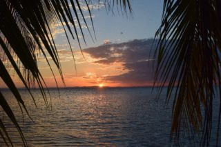
The striking views of Concepcion can be seen from anywhere on the island, Lake Nicaragua or the town of San Jorge where we got on the boat that would take us to the island.
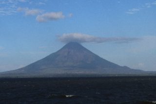
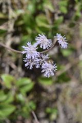
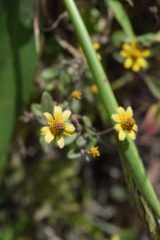
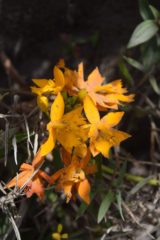
Volcan Concepcion, with a height of only 5,282 feet, is the highest point on Ometepe Island in the middle of Lake Nicaragua, close to Granada. The trail starts at the base of the volcano, and during our trek we passed through a savannah, primary and secondary dry forest and pre-mountain forest. The landscape and flora seemed to be constantly transforming.
One really neat feature of the trip was passing an enormous Ceiba tree, the national tree of Guatemala and icon of Central America. It sits at the beginning of the trail and is one of the few big trees — it stands about 60 meters (197 feet) tall — left in the hike’s primary forest.
The first part of hike is pretty flat navigating through the farmlands, but once you reach the rainforest, the trail starts to get steeper with several switchbacks. After a few hours we reached a flat area above the tree line where we took a break and had snacks. From here you can see the lake and west side of the island as well as the volcano. The volcano was completely covered in clouds at that moment with the top cone nowhere to be seen. After our short break we continued on the “trail” straight up lava sand and rocks. The incline was about 35 degree angle with high winds and high exposure, it got real steep real fast. That, along with the high winds and cold weather ‘persuaded’ some fellow hikers to turn around at this point as they felt summit was too far. As we continued towards the top of volcano, the trail became more narrow and slippery, much more challenging than before. We were lost in the clouds with zero visibility, the wind was forceful, making it hard to keep our balance, with a sheer drop on either side us to motivate us.
About 45 minutes from the top we started to smell sulfur. We continued hiking, about 10 mins before the summit we had to ditch our walking sticks behind and go on all fours in order not to fall off the mountain. At this point there is no trail, and you reach the summit in a scramble. The summit of the volcano is very small, with the volcano cone on one side (the smell of sulfur overwhelming you), and cliff drops on other side. It is recommended to spend only up to 10 mins on the top due to the volcanic gas. Chemicals like sulfur, carbon monoxide and bleach create a poisonous combination. Let me remind you, this is an active volcano. While it hasn’t had a major eruption in the last 50 years, it did shoot out an ash cloud in 2010. An eruption might seem unlikely, but can occur, which is why this climb is only on your own risk. Our guide prompted us to start our descent as the wind was getting stronger and might knock us off the mountain.
The way down is an adventure on its own. As you know, getting to the summit is only half of the work and getting down from an active volcano and navigating through slippery wet rocks, volcanic ash, sand and steep drop offs is not easy. On our way down the fog lifted and we saw the volcano and its surroundings in full blown beauty. It got pretty hot and humid hiking down and we were able to really appreciate the beauty of this place.
On the way down I spotted several white Capuchin monkeys and interesting birds. The climb up and down took about 8 hours and I would rate it as medium difficulty.
What I recommend:
1. A guide is mandatory to hike the volcano. It’s very steep with sharp, jagged rocks and there is a trail only part of the way up. If you’re caught without a guide, you will be fined. Remember it’s also an active volcano and has been known to expel magma rocks without much warning. You want someone knowing what they’re doing up there and the safe places to walk. The peak of Volcano Concepcion is at a height of 5200 ft, and the hike starts at an elevation of 426 ft – so it’s quite a climb. We started the hike at about 6:30am. The hike takes on average between 8-10 hours return. No hikers are allowed up after midday.
2. Bring extra layers! It gets cold and windy at the top. I suggest bringing bandanna to cover your mouth so you don’t breathe in the toxic gas.
3. Bring good hiking shoes or boots, no tennis shoes. You will need a good grip when hiking on the slippery terrain.