Hiking around Mount Baker Wilderness in Pacific Northwest

239874067_10159117464343941_3600515304437930534_n

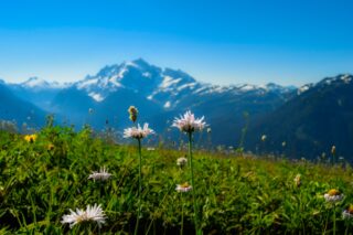
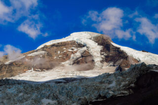
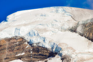
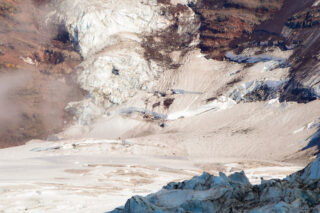
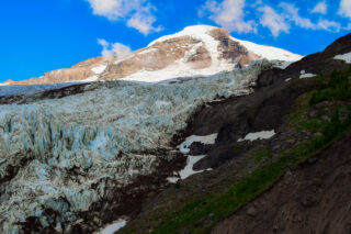
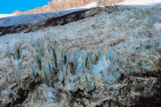
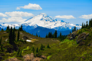
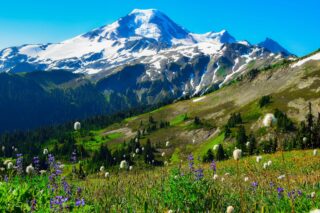
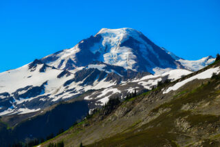
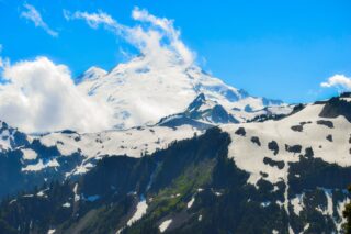
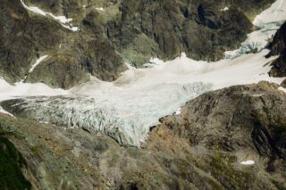
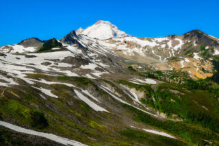
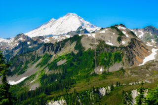
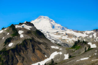
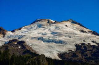
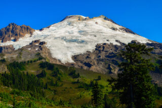
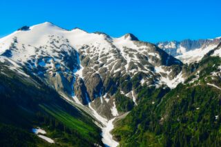
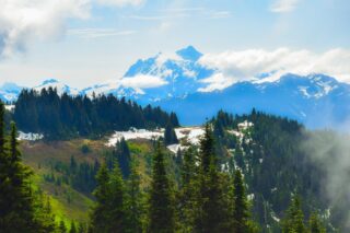
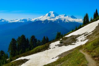
Mount Baker, also known as Koma Kulshan or simply Kulshan, is a 10,781 ft active glacier-covered andesitic stratovolcano in the Cascade Volcanic Arc and the North Cascades of Washington in the United States. Mount Baker has the second-most thermally active crater in the Cascade Range after Mount St. Helens.

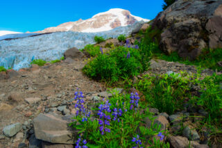
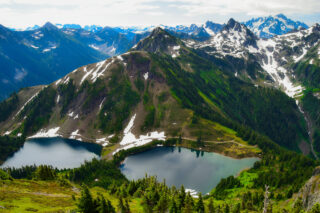
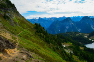
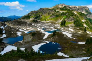
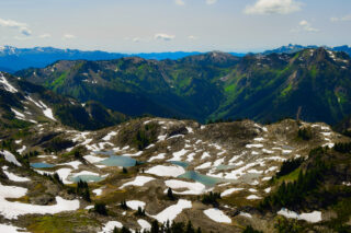
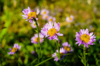
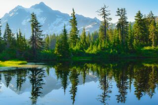
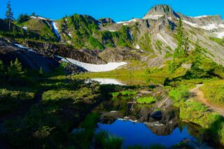
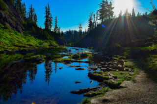
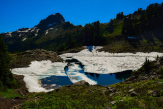
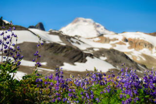
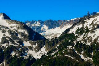
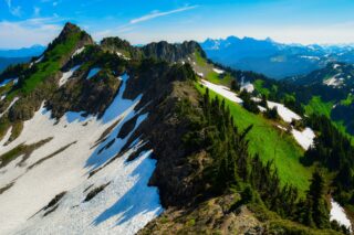
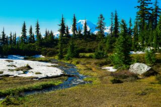
The area around Mount Baker is some of the most scenic in Pacific Northwest. Many beautiful trails leads to alpine lakes, sweeping mountain vistas and beautiful forests and waterfalls.

Heliotrope Ridge
5.5 miles, roundtrip
Gain: 1400 ft.
Highest Point: 5100 ft.

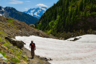
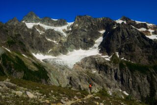
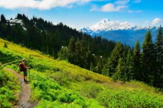
This trail shares access to a popular climbing route on Mount Baker and the trail is well traveled and in great shape. From the trailhead, it quickly enters the Mount Baker Wilderness and meanders gently among big trees, bridged creeks, and peek-a-boo views of Mount Baker (10,781 feet).

 
Winchester Mountain Lookout
3.4 miles, roundtrip
Gain: 1300 ft.
Highest Point: 6521 ft.
The historical Winchester Lookout, located in the North Cascades in the U.S. state of Washington, provides views of the Northern Picket Range, Mount Baker, Mount Shuksan, Mount Larrabee, and Canadian peaks. The steep snowfields usually require an ice-axe well into July.
 
 
Yellow Aster Butte
7.5 miles, roundtrip
Gain: 2550 ft.
Highest Point: 6150 ft.
Yellow Aster Butte is a 6,241-foot Skagit Range summit located three miles south of the Canada–United States border, in Whatcom County of Washington state. It is situated within the Mount Baker Wilderness, on land managed by Mount Baker-Snoqualmie National Forest.
 
 
Skyline Divide
9 miles, roundtrip
Gain: 2500 ft.
Highest Point: 6563 ft.
The Skyline Divide is a 6000-foot-high northward extension of Koma Kulshan that transforms itself into a summertime paradise of unrivaled mountain views and unending wildflower fields.
 
 
Artist Point – Picture Lake
0.5 miles, roundtrip
Gain: 45 ft.
Highest Point:4157 ft.
 
Artist Point Is A Great Viewpoint For The Cascades, With Sweeping Views Of Baker Lake. Learn About The Beautiful Views That You Can See From The Trailhead! Breathtaking Views. Picture Lake is a  home to one of the most photographed vistas in America. Featuring a backdrop of craggy Mount Shuksan and a foreground of wildflowers ringing a sparkling lake in summer.
 
 
Huntoon Point
1.5 miles, roundtrip
Gain: 200 ft.
Highest Point: 5150 ft.
 
There is never a dull view on this hike, with Shuksan and Baker dominating, but also providing panoramas of American Border Peak, Mount Larrabee, Goat Mountain and more to the north, and even a peak of Mount Stuart to the south. But don’t forget to look at the little things. Cold, glacial tarns dot this landscape – a delight for photographers. Tenacious flowers poke their buds out for a brief glimpse of late summer. And gnarled trees and stumps provide testament to the vast amount of snow the ridge gets every year.
 
Chain Lakes Loop
6.5 miles, roundtrip
Gain: 1820 ft.
Highest Point: 5400 ft.
This gorgeous loop hike has it all: big views of Mounts Baker and Shuksan, as well as the North Cascades, alpine lakes for swimming, and well-maintained trail winding through meadows and heather. And with wildflowers in spring, blueberry bushes for trail-side snacking in late summer and blazing color in the fall, you can’t pick a bad season to visit.
 
 
Lake Ann
8.2 miles, roundtrip
Gain: 1900 ft.
Highest Point: 4900 ft.
Enjoy up-close, breathtaking views of Mount Shuksan’s west face, along with views of Fisher Chimney, the upper and lower Curtis Glacier, as well as Mount Baker from the trail to Lake Ann. The lake in a rocky basin, in the midst of this spectacular scenery. On some days you can hear ice echoing through the valley as it crashes down the face of Mount Shuksan. This is a late season hike, as snow can linger here into August.
 
 
Ptarmigan Ridge
9 miles, roundtrip
Gain: 1800 ft.
Highest Point: 6100 ft.
This trail will lead you stunningly close to the east side of Mount Baker. The way is rocky from start to finish, lined with lupine and sedges, and patches of blueberries.
 
 
Park Butte Lookout
7.5 miles, roundtrip
Gain: 2200 ft.
Highest Point: 5450 ft.
On Park Butte, hike to an historic fire lookout and come face-to-face with Koma Kulshan. Along with unobstructed panoramic views of Mount Baker, the Twin Sisters, and the rest of the North Cascades, the route to Park Butte offers dedicated campsites, wildflower-filled alpine meadows, rushing waterfalls, and a stunning variety of mushroom species.
 
 
Hannegan Peak
10.5 miles, roundtrip
Gain: 3100 ft.
Highest Point: 6200 ft.
 
The wide-open trail to Hannegan Pass and Hannegan Peak offers spectacular mountain views, glorious alpine wildflowers, waterfalls and glaciers. The trail up to Hannegan Peak begins with steadily graded switchbacks that weave through forest and beautiful alpine meadows with views of Ruth Mountain that improve as you climb. At the summit, enjoy 360 degree views of Cascade peaks, including Goat Mountain, the High Divide, and the Nooksack Ridge to the west. To the north are the peaks of British Columbia and the remote Silesia Creek valley, and to the east, Copper Ridge is visible, as well as Mount Redoubt in the distance. But the southern view is by far the most commanding, with in-your-face vistas of Mount Baker and Ruth Mountain, as well as Mount Shuksan, the East Nooksack Glacier and the Nooksack Tower.
 
 
Excelsior Peak
8 miles, roundtrip
Gain: 3600 ft.
Highest Point: 5400 ft.

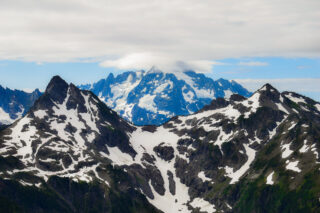
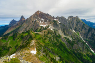
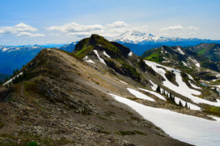
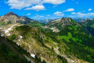
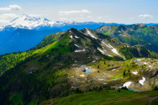
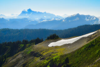
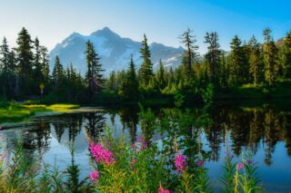
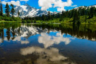
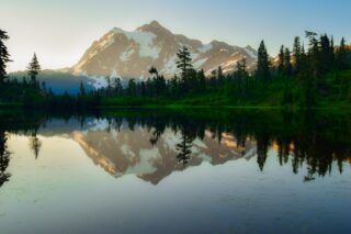
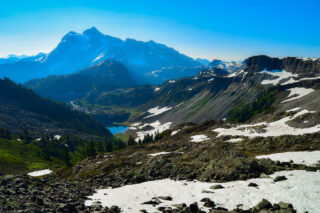
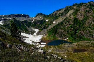
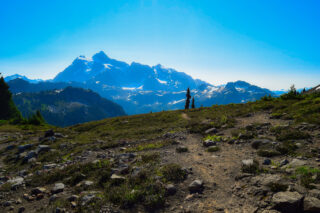
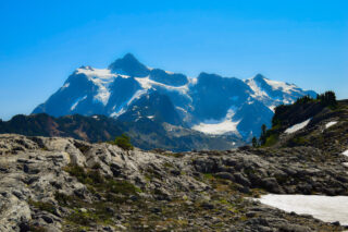
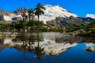
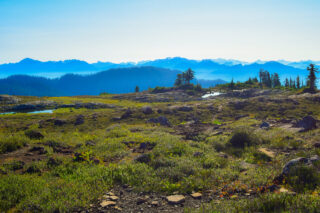
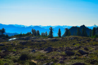
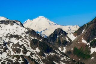
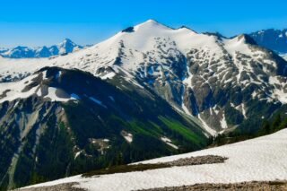
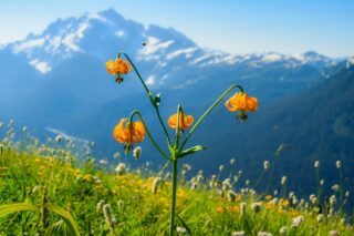
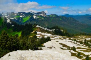
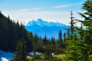
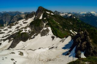
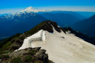
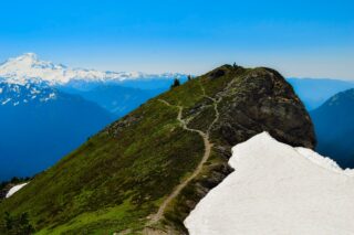
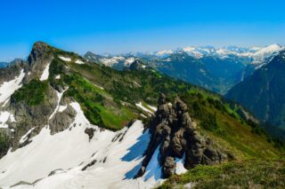
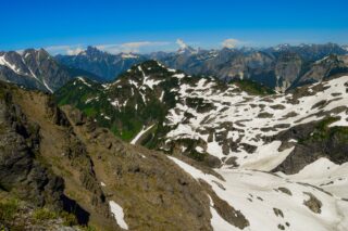
This hike never disappoints. Views of Mount Baker, Mount Shuksan and the Nooksack Valley are just a few of the many peaks and valleys that make up the scenery. From Excelsior peak, hikers can continue east along the High Divide to enjoy more spectacular mountain scenery.

 
Church Mountain
8.5 miles, roundtrip
Gain: 3800 ft.
Highest Point: 6100 ft.
 
 From this peak, you will get a fantastic 360-degree view of Mount Baker, Mount Shuksan, Damfino Lakes, Border Line Peaks, Goat Mountain, Excelsior Pass and Skyline Ridge in the background.
 
 
Goat Mountain
8.5 miles, roundtrip
Gain: 3100 ft.
Highest Point: 5600 ft.
 
On this hike, you will definitely earn the views. It starts in deep forest but soon reaches open slope of the mountain. The official trail follows a spectacular ridge crest for the last mile,  terminating at 5,600 feet with views to craggy Mounts Sefrit, Shuksan, Baker and many more. An unofficial trail continues another 0.8 mile and 1,000 vertical feet to the false summit of 6,600-foot West Goat Mountain.
 
 
Welcome Pass
4.6 miles, roundtrip
Gain: 2800 ft.
Highest Point: 5200 ft.

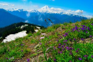
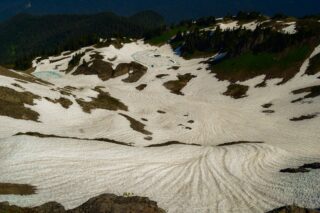
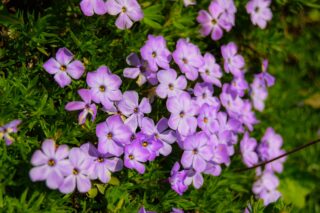
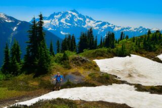
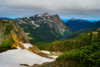
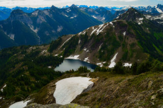
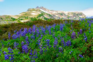
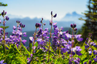
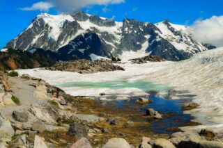
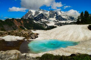
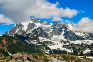
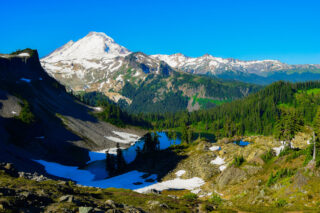
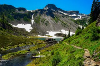
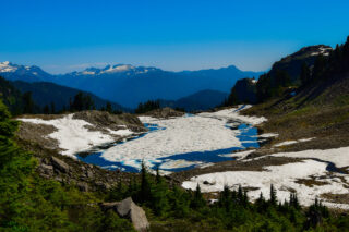
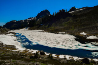
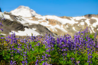
 This is one of the access points to High Divide,  this trail ascends through the steep forest, delivering hikers onto the ridge without wasting any time or ground. You will be rewarded with  jaw-dropping views of Mount Shuksan and  glimpses of Price Lake, a glacier-fed beauty on the side of Shuksan. If you continue westward to the ridge, your walk will be a flower lined journey with views of Komo Kulshan (Mount Baker).


Share this post