John Muir, also known as “John of the Mountains” and “Father of the National Parks”, was an influential Scottish-American naturalist, author, environmental philosopher, botanist, zoologist, glaciologist, and early advocate for the preservation of wilderness in the United States of America.
His letters, essays, and books describing his adventures in nature, especially in the Sierra Nevada, have been read by millions. His activism helped to preserve the Yosemite Valley and Sequoia National Park, and his example has served as an inspiration for the preservation of many other wilderness areas. The Sierra Club, which he co-founded, is a prominent American conservation organization. In his later life, Muir devoted most of his time to the preservation of the Western forests. As part of the campaign to make Yosemite a national park, Muir published two landmark articles on wilderness preservation in The Century Magazine, “The Treasures of the Yosemite” and “Features of the Proposed Yosemite National Park”; this helped support the push for U.S. Congress to pass a bill in 1890 establishing Yosemite National Park. The spiritual quality and enthusiasm toward nature expressed in his writings has inspired readers, including presidents and congressmen, to take action to help preserve large nature areas.
John Muir has been considered “an inspiration to both Scots and Americans”. Muir’s biographer, Steven J. Holmes, believes that Muir has become “one of the patron saints of twentieth-century American environmental activity,” both political and recreational. As a result, his writings are commonly discussed in books and journals, and he has often been quoted by nature photographers such as Ansel Adams.” Muir has profoundly shaped the very categories through which Americans understand and envision their relationships with the natural world,” writes Holmes.


Muir built a small cabin along Yosemite Creek, designing it so that a section of the stream flowed through a corner of the room so he could enjoy the sound of running water. He lived in the cabin for two years and wrote about this period in his book First Summer in the Sierra (1911). Muir’s biographer, Frederick Turner, notes Muir’s journal entry upon first visiting the valley and writes that his description “blazes from the page with the authentic force of a conversion experience.”
Pursuit of his love of science, especially geology, often occupied his free time. Muir soon became convinced that glaciers had sculpted many of the features of the Yosemite Valley and surrounding area.
Muir made four trips to Alaska, as far as Unalaska and Barrow. Muir, Mr. Young (Fort Wrangell missionary) and a group of Native American Guides first traveled to Alaska in 1879 and were the first Euro-Americans to explore Glacier Bay. Muir Glacier was later named after him. He traveled into British Columbia a third of the way up the Stikine River, likening its Grand Canyon to “a Yosemite that was a hundred miles long”. Muir recorded over 300 glaciers along the river’s course.
He returned to the hills to recover, climbing Mount Rainier in Washington and writing Ascent of Mount Rainier.
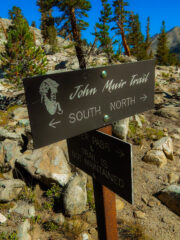
The John Muir Trail (JMT) is a long-distance trail in the Sierra Nevada mountain range of California, passing through Yosemite, Kings Canyon and Sequoia National Parks. From the northern terminus at Happy Isles in Yosemite Valley and the southern terminus located on the summit of Mount Whitney. The Trail’s length is 213.7 miles (343.9 km), with an elevation change of approximately 47,000 feet (14,000 m). For almost all of its length, the trail is in the High Sierra backcountry and wilderness areas. For about 160 miles (260 km), the trail follows the same footpath as the longer Pacific Crest Trail. It is named after John Muir.
The vast majority of the trail is situated within designated wilderness. The trail passes through large swaths of alpine and high mountain scenery, and lies almost entirely at or above 8,000 feet (2,400 m) in elevation. The trail has been described as “America’s most famous trail”; the trail sees about 1,500 thru-hiking attempts each year (including Pacific Crest Trail thru-hikers), many fewer than the number of attempts on comparable walks such as the southern portion of Appalachian Trail or the Way of St. James.
From its northern terminus in Yosemite Valley, the trail runs southeast, passing south of Half Dome and then on to Tuolumne Meadows. From Tuolumne Meadows the trail turns south, running parallel to the main range of the Sierra Nevada, through Yosemite National Park, Inyo and Sierra national forests (including the John Muir Wilderness and Ansel Adams Wilderness), passing through Devils Postpile National Monument, Kings Canyon National Park, and ending on Mount Whitney in Sequoia National Park. From the southern terminus of the JMT at the summit of Mount Whitney, an additional 10.6-mile (17.1 km) hike on the Mount Whitney Trail is required to reach the nearest trailhead at Whitney Portal, thus making an end-to-end traverse of the JMT effectively 221 miles (356 km).
Mount Whitney’s summit is on the Sierra Crest and the Great Basin Divide. It lies near many of the Sierra Nevada’s highest peaks. In July 1864, the members of the California Geological Survey named the peak after Josiah Whitney, the State Geologist of California and benefactor of the survey.
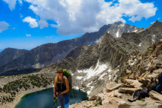


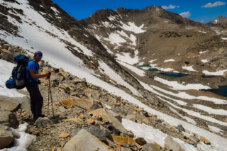
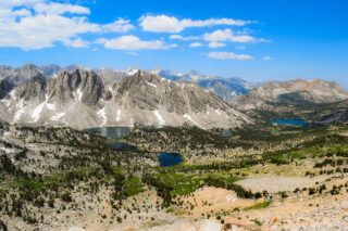
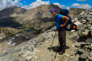
I have previously section hiked most of the John Muir Trail, additionally completing the Rae Lakes Loop, which is ultimately my favorite part of the trail. I came back couple years after I completed the loop and backpacked to Kearsarge and Rae Lakes and spent several days exploring the area. The Rae Lakes Loop is one of the most popular hikes in Sequoia and Kings Canyon, if not in the entire Sierra. The loop is 41.4 miles long, and climbs from 5035′ (1535m) at the trailhead to 11,978′ (3651m) at Glen Pass. High water at stream crossings can be a problem in May and early June. Glen Pass may be impassable to hikers until mid-late July and even later for stock. Camping is only allowed at designated campsites and backpackers need permit that allows them to camp in the backcountry.

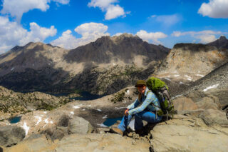
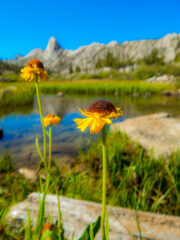
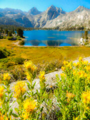
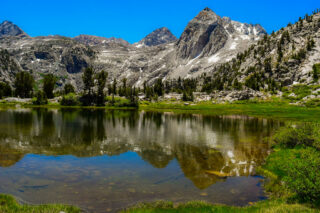
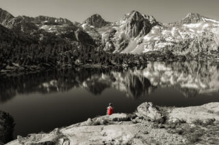
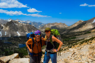
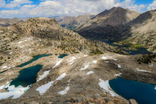
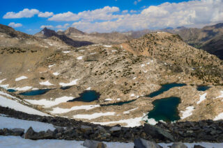
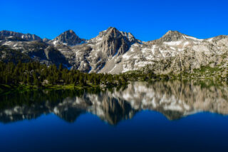
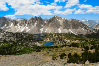
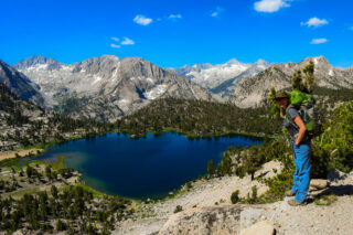
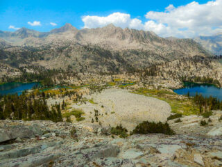
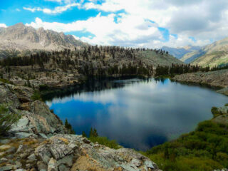
My favorite parts of the hike is Kearsarge Pass & Kearsarge Lakes. This scenic trio of lakes lies nestled against the base of the Kearsarge Pinnacles. You will find abundant campsites along the first and second lakes. Although there is a bear box on the north end of the first lake, the park currently (as of 2017) leaves it locked. You will need to bring your own means of food storage in order to protect your food. A second cluster of campsites lies on the west side of the second lake along an informal path. This informal path continues south to the third and largest of the trio. The third Kearsarge Lake is the most beautiful, particularly on a calm morning when the lake’s placid surface reflects a mirror image of the Kearsarge Pinnacles. With an established base camp at Kearsarge Lakes on your first night, you can either relax along the banks of the lakes, or you can continue hiking west for a visit to Bullfrog Lake. The park forbids camping near Bullfrog Lake, but since it is arguably the most scenic of all of the lakes in the basin, I recommend you spend as much time along its banks as possible.
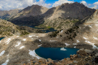
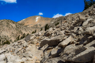

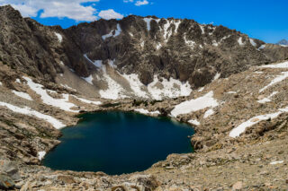
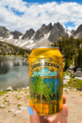
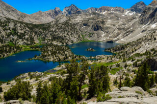
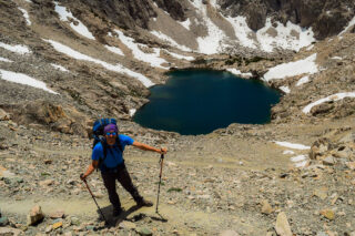
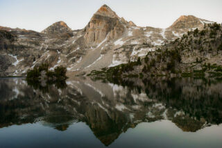
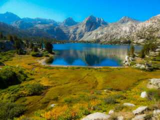
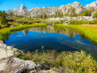
Now onto the main star – Rae Lakes. From Kearsarge Pass & Lakes, all you need to do is to get over Glen Pass and then you will see the real beauty. The pass itself is very rocky in some spots and has many switch backs until you reach the top. Have a camera at the ready, because that summit is oozing with amazing views of the Sierra Crest. It is a killer hike along the Rae Lakes. For a side trip, you can add a 4 mile round trip hike if you so choose to take it – The 60 Lakes Basin Hike. It’s a very beautiful hike and definitely worth doing! You can spend days in the Rae Lakes basin, exploring side trails, fishing or just relaxing.


Permits:
To hike the Rae Lakes Loop, you will need to obtain a wilderness permit from Kings Canyon National Park (managed conjointly with Sequoia National Park). The quota period for permits is currently May 16th to September 26th (at time of writing). During this time, the park restricts the number of visitors departing from a specific trailhead on a specific day. Outside of the quota period, there are no restrictions, although conditions are often less conducive to backcountry travel. You can pick up your permit from local ranger station.
The reason for picking up the permit from the ranger stems in part from the park’s desire to have the ranger review basic safety considerations. The park’s primary concern is that you carry an approved bear canister to protect your food from bears. This requirement comes in spite of the fact that there are food storage lockers placed at nearly every developed camping area along the route. Hikers should not count on the availability of space in these lockers as heavy trail use may make space unavailable or insufficient. The ranger station at Road’s End rents out a variety of bear canisters.